An Ancient Landscape
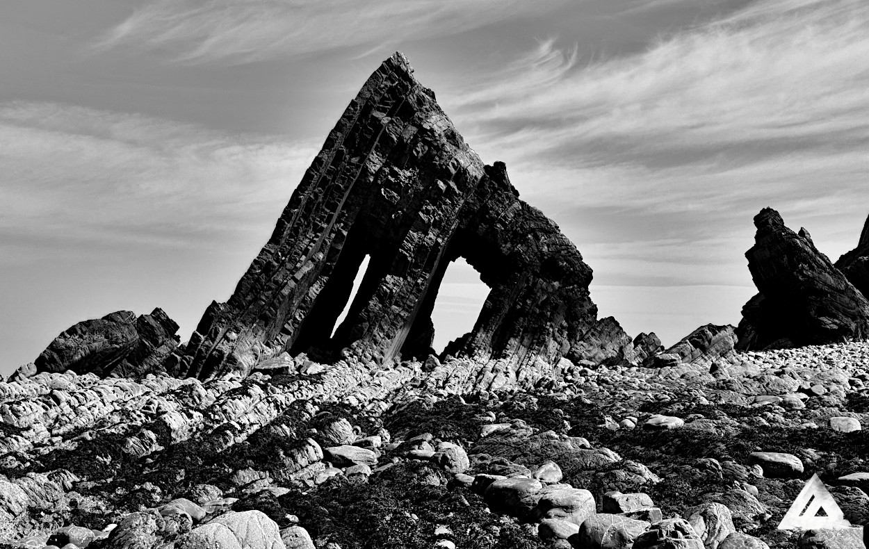
Blackchurch Rock is an elegant and enduring monument to strength and natural history. Mouthmill valley is awe inspiring in its truest sense. Its hard to pass by and remain uninspired, and it seems this has been the case for many thousands of years...
A Human History
2500-1500 BC - Burial Ground
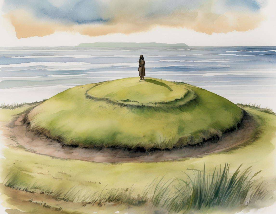
Bronze Age people picked this location as a sacred burial site. A large round burial mound known locally as "Gallantry Bower", a 20-meter Bell Barrow sits on the summit of the East cliff. There is another tumulus 100 metres away, and rumours of a rare square barrow to the south. This area was chosen as a sacred haven by prehistoric people.
800-500 BC - Hillfort
Late Bronze Age to Early Iron Age, Windbury Head Hillfort was established on the west cliff on a hill called Windbury Mead. The name Windbury comes from a combination of 'winn' meaning pasture and 'bury' meaning a defended settlement. This fort is around 35 x 90 metres long and had a large rampart and ditch surrounding it. The northern edge of the fort used the natural defence of the cliff. Due to this the Northern edge is slowly eroding and slipping down to the beach below. It is thought that there may have been a moat on the West side. Remaining earthworks of the fort are accessible on the coast path which passes directly through the site. After the decline of the hill fort the Windbury promintory was used as the location for a coastal beacon. On 13th April 1942 a Wellington Bomber tragically crashed into the cliffs below.
700-1200 AD - Celtic decline
Kernewek, the Celtic language spoken here for centuries slowly died out as locals were absorbed by the English and colonized by the Saxons. Its hard to imagine but until approximately this date, the indigenous tribes of Devon and Cornwall (then one nation called Dumnonia) had a distinct language and culture, very different to that of the East Country. Kernewek (Cornish) is similar to the other Celtic languages such as Welsh, Irish, Scots, Manx and Bretonic. It is now almost completely forgotten but has seen a recent revival in Cornwall. Dydh Da!
1500s - Smuggling
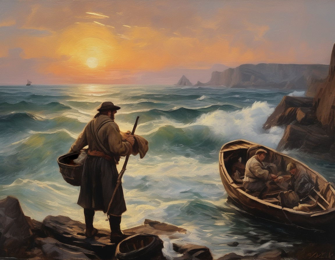
Mouthmill Beach served as a discreet cove hidden between major towns, providing cover for ships and boats traveling to the bustling ports of Bideford and Barnstaple, which were among the largest in Britain during the 16th and 17th century. The South West was known for piracy and non-conformity, and numerous secret caves, coves and landings were often used by sailors to bring wares ashore away from prying eyes. Mouthmill valley has a gentle slope, and Brownsham Woods might provide good cover to anyone wishing to bring in contraband or avoid customs.
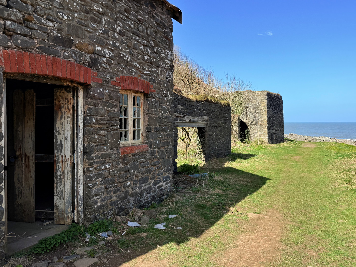
1600s - Mill
The mill of Mouthmill has been converted into a picturesque cottage nestled at the bottom of the valley. A leat ran along the northern side of the valley, ending in a mill pond near the roof behind the house. A sluice would have controlled the substantial head of water onto a wheel. The wheel was likely on the south wall of the building owing to the offset chimney and position of the sluice gate, however there is no sign of a tail race. If you have more information about the history and workings of the mill please get in touch.
1700s - Lime Kiln.
A grade II listed single pot lime kiln in excellent condition lies prominently at the bottom of the valley, complete with inclined plane from the foreshore, and another plane leading down to the coal shed behind. Small boats carrying limestone would come over from South Wales and cast their rocky cargo onto the shore at high tide. At low tide, workers would carry the limestone up the inclined plane and create alternating layers of limestone and coal inside the bowl of the kiln. Once burned the resulting quick lime would be crushed into a powder and used as a fertilizer or to make cement. Lime was imported as the local geology lacks naturally occurring calcium carbonate. Imported lime supercharged the economy of the West country and the wider country in the 1700s and beyond.

On low tides you can still clearly see the channel cut into the rock for the boats to approach the kiln, which originally was surrounded by mooring posts. The small limers cottage was later built next to the coal shed. There was another earlier kiln pot dug into in the clearing on the other side of the inclined plane making it a glorious dual potter, but unfortunately very little of it remains.
It is possible to climb the inclined plane to look into the top of the bowl, but beware it is extremely dangerous as the top is overgrown and you could easily slip and become trapped in the deep brick lined bowl.
There used to be hundreds of lime kilns along the North Devon coast and along the Torridge and Taw rivers. These days only a fraction are still standing.
1800s - The Hamlyns
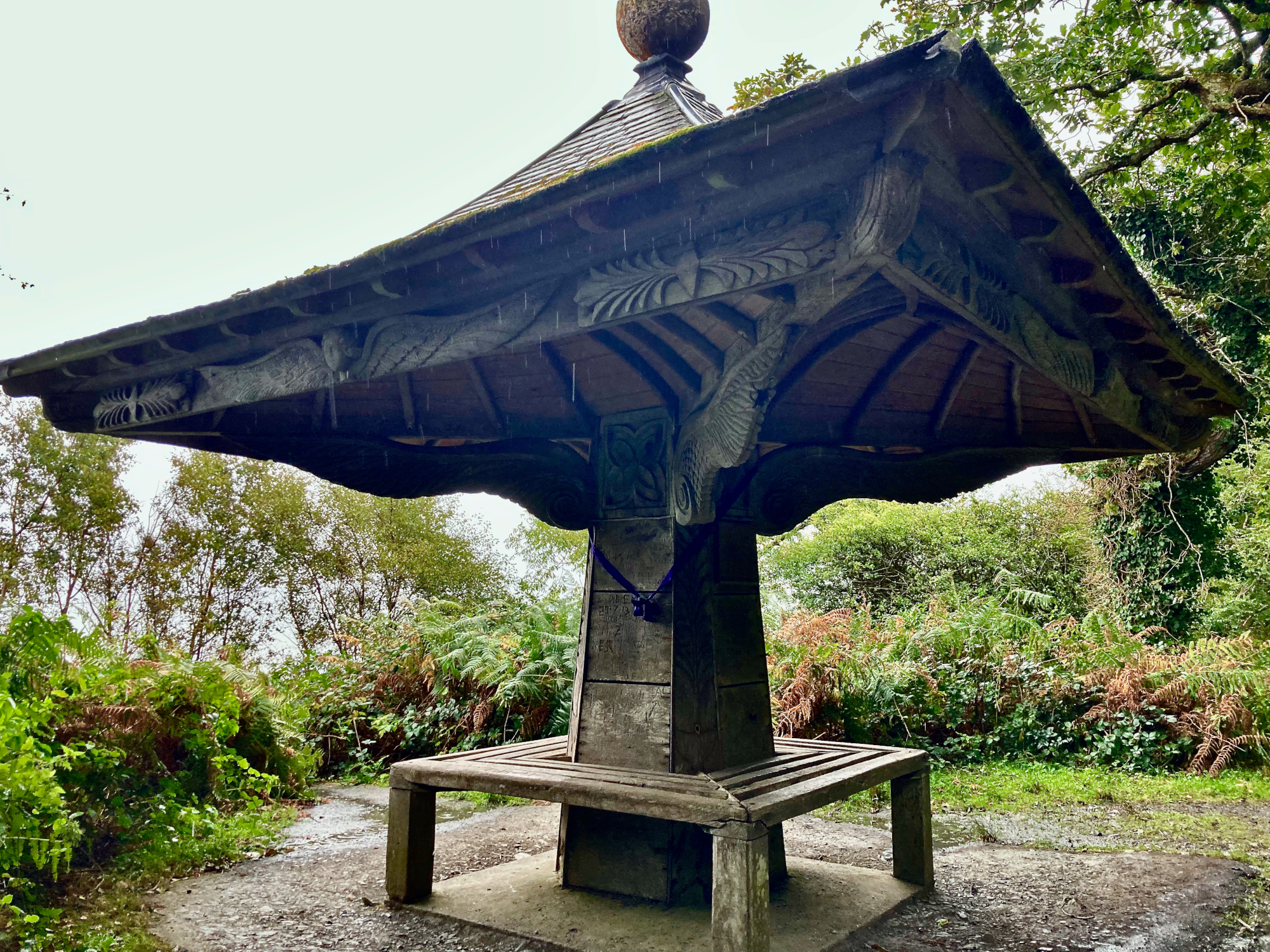
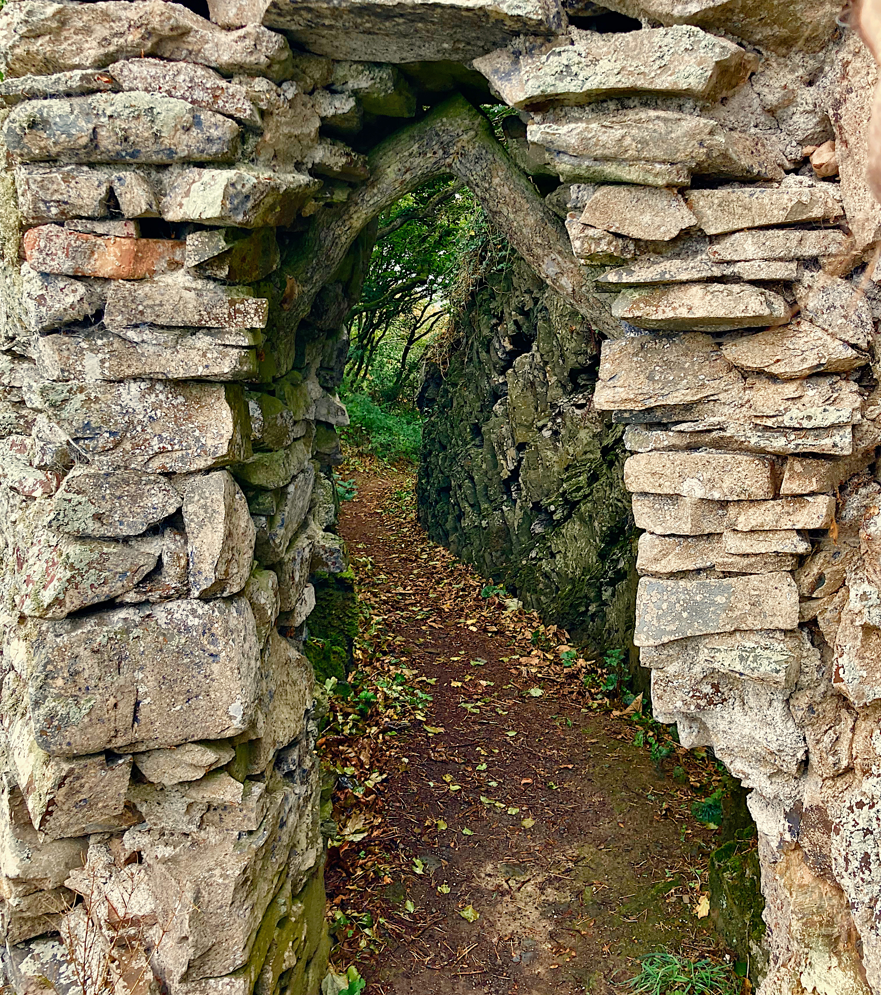
High on the Eastern hill, in the woodland called "The Wilderness" is a single room stone summerhouse built in 1820. This was part of a slew of structures built by the Hamlyns of Clovelly Court in the early 1800s. Nearby, a cobbled balcony was cut into the cliff at the rear, giving sea views to the North East. The balcony is accessed by a footpath leading to a stone archway, with "CAVE" engraved on one of the rocks. Further along the Eastern cliff path, past Gallantry Bower, is a wooden shelter known as "Angels Wings". Built originally in 1826, this is a romantic wooden shelter featuring beautifully ornate carvings and a welcome place to shelter from rain and to rest weary feet.
1900s - to present day
A concrete lookout was built near the summer house during the Second World War, which is now know as the "Blackchurch Rock viewing point" Grid Ref: SS 300 265.
On the 13th of April 1942 a Wellington Bomber flying from Chivenor tragically crashed into the cliffs at Windbury Point in poor weather. All 5 crew members from the 172 squadron were lost. Two days later the tail of the bomber was found at the cliff by another aircraft. A memorial plaque was erected in 1988 on the coastpath at Windbury Head.
A private unmetalled road from Clovelly Court to the Cottage was laid, and a harbour wall has been built to protect the road. A large game farm nearby has regular shoots in Mouthmill valley, evidenced by many wooden hunting platforms and spent shotgun cartridges on the footpaths.
With the dawn of the internet and social media, Blackchurch Rock is becoming less obscure and is taking its rightful place in the realm of most beautiful natural phenomenon in Britain. It was recently placed as the number one sea stack in the country by BBCs Country File magazine website.
Miniature Ecosystems
Rock pools
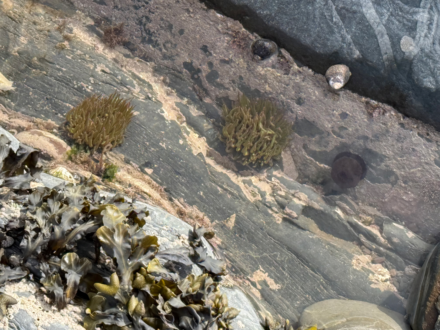
The shoreline rocks have many crevices which trap sea water when the tide goes out, forming little unique micro biomes. These rock pools (or tide pools) support a variety of marine life, from tiny algae and crustaceans to small fish and sea anemones. Seaweed and pebbles provide shelter and shade for the creatures. Exploring these rock pools can be like discovering a microcosm of marine biodiversity, though it is important to be respectful to the fragile life on display. Be cautious because some of the common anemones and jellies minding their own business in these pools at Mouthmill can sting.
Lundy Island
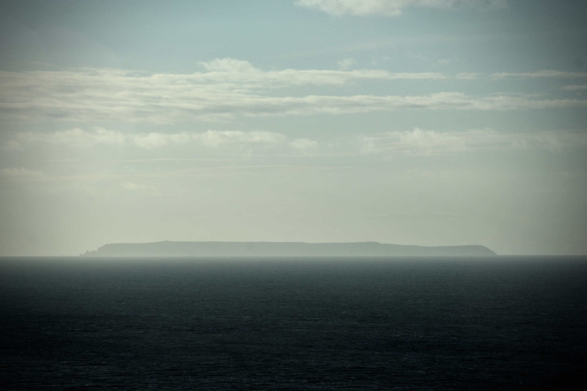
If you find yourself standing on the shore at Mouthmill on a clear day and gazing out to sea, you will notice an island on the horizon. This is Lundy Island - a stunning granite outcrop about 22km (14 miles) away. Around 30 people live on the island, which is owned by the National Trust. Lundy has a long interesting history of Celtic stones, shipwrecks, piracy and even the Knights Templar! Lundy is also known for its unique wildlife - Puffins, Lundy ponies and Dolphins to name a few. Many of the nearby churches have arches built of sturdy Lundy granite.
Day trips and accommodation are available if you would like to visit Lundy. The island is small but does have a general store, a pub and a church. The MS Oldenburg departs Bideford and Ilfracombe on calm days, and a helicopter from Hartland can be booked during the winter. The Landmark Trust has several buildings available to book for longer holidays on the island. A circular walk around the entire coast of the island is around 12km (7 miles), and is very hilly.
Order this original photo on canvas.
This is a special place
The valley has lots of interesting archaeological and geological sites and surely many more to discover. The history of Mouthmill serves as an allegory for the history of the South West. It is easy to see why it was named after a church.
I hope you enjoyed reading this page about the human history and landscape of Mouthmill. If you haven't yet, please take the time to read about the Geology of the stones, and if you want a miniature Blackchurch Rock to adorn your home or business then please visit the Sculptures page. Printed photographs are also available which help support this website. All photos on this site are original and up to date, taken between 2024 and 2025. If you have questions, suggestions or comments, please get in touch. Thank you for visiting!
Buy a BCR sculpture by a local artist.