Where is Blackchurch Rock?
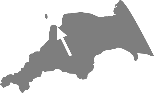
Blackchurch Rock is located at Mouthmill Beach, on the North Devon Coast in South West England. It is a couple of miles from the border with Cornwall.
Postcode: EX39 5TA
Map Coordinates: 1.0139, -4.4263
What 3 Words: castle.hiker.green
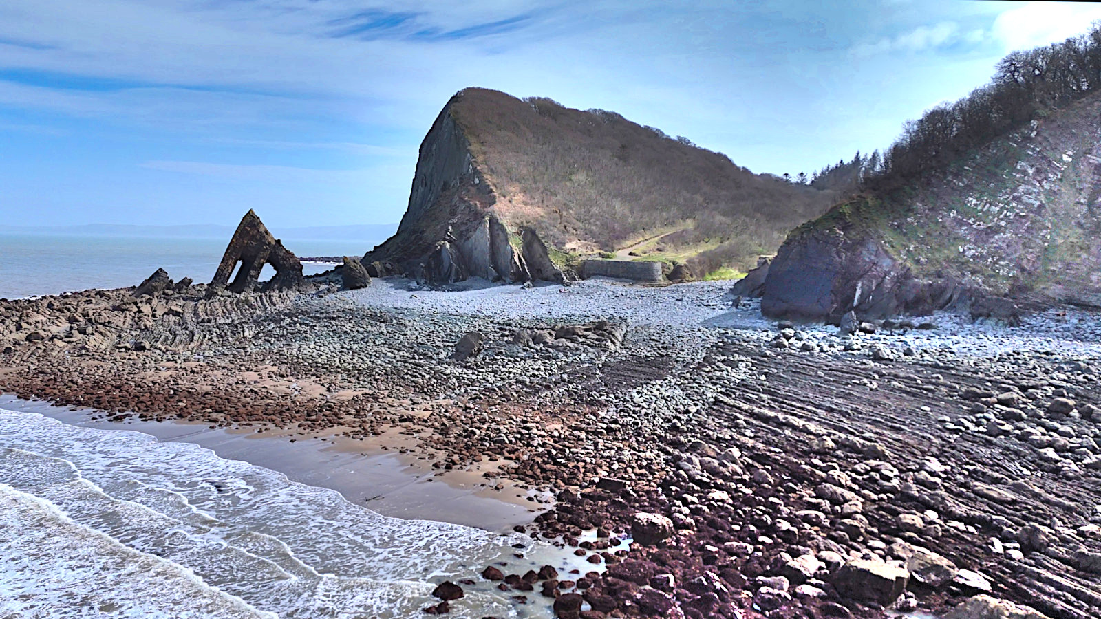
Blackchurch Rock is situated on the rocky foreshore at the bottom of a rural wooded valley.
During high tides, the coast will be inaccessible, so it’s a good idea to check the tide times on the day you plan to visit to make the most of your trip.
How do I get there?
Blackchurch Rock is only accessible via footpaths. Below are the best options:
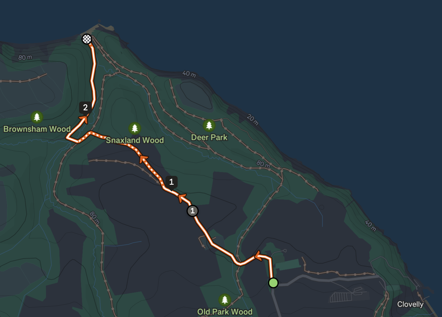
Brownsham Car Park
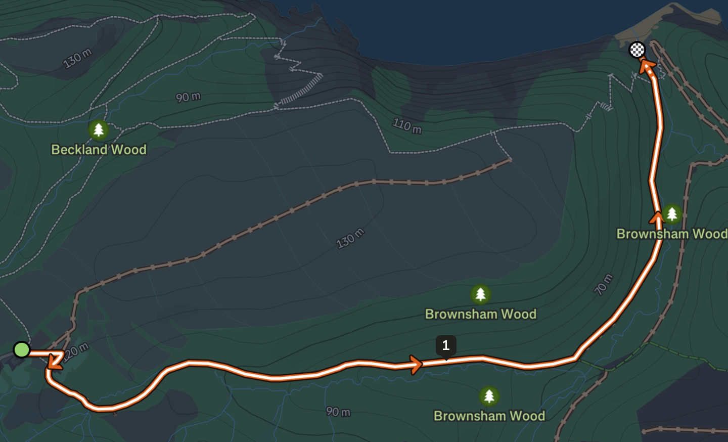
- Distance: 2.1 kilometres / 1.3 miles
- Elevation:

 Strava Route
 Komoot Route
 GPX File Route Download
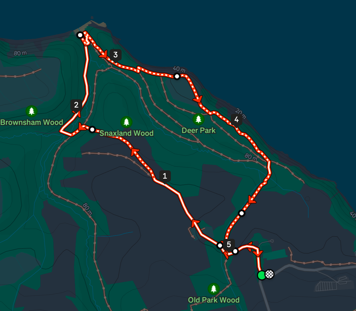
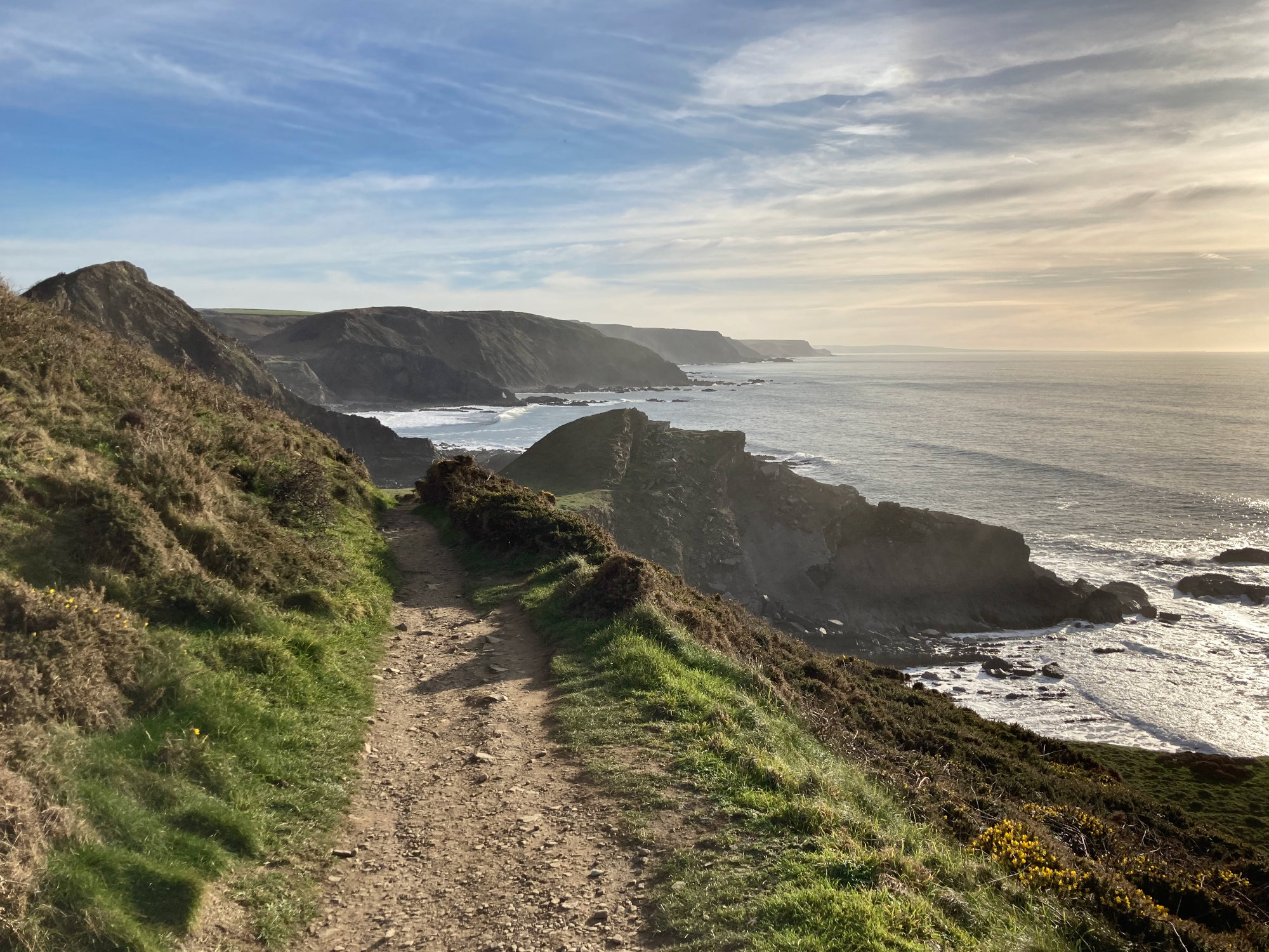
The footpath from the National Trust operated car-park at Brownsham is the easiest way for walkers to reach Mouthmill Beach. The car park is free and has a coin slot donation box. The path is generously wide and descends gently and predictably down a steady 8% gradient through Brownsham woods. In Brownsham there is a former cow shed which has been turned into a National Trust operated Bothy which can be booked online. Current prices are between £25 and £50 per night.
Clovelly Court (2.5 kilometres / 1.55 miles)
- Elevation:

- Strava Route
- Komoot Route
- GPX File Route Download
This route takes you on a descent of the East side of the valley. It leads you through a busy game farm so walking pets here is discouraged. This way has some extremely steep hills and stiles to climb.
Circular Walks
Brownsham Circular
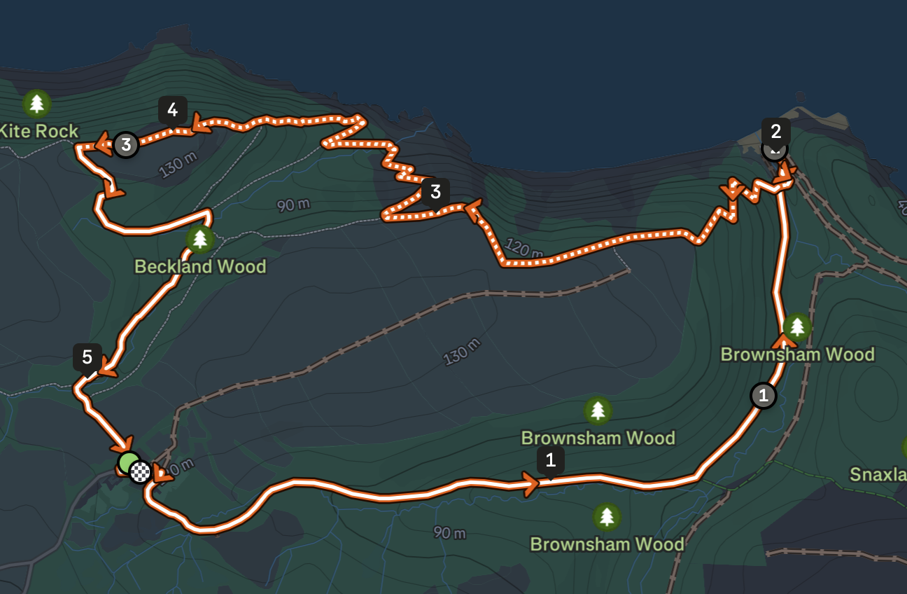
- Distance: 5.2 kilometres / 3.2 miles
- Elevation:
- Strava Route
- Komoot Route
- GPX File Route Download
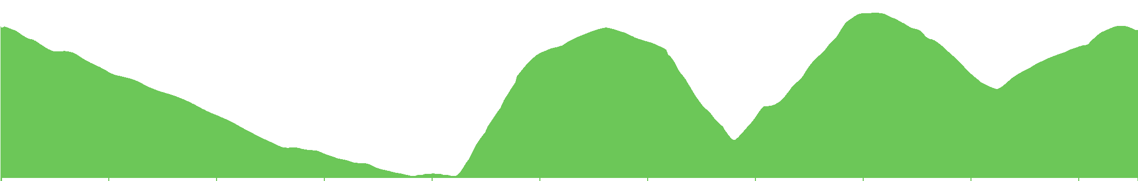
The footpath from the National Trust operated free car-park at Brownsham descends gently and predictably down a steady 8% gradient through Brownsham woods. After visiting Mouthmill Beach, the route takes in Windbury Hillfort to the west, arriving back at the car park from a northerly direction. The return leg of this route is extremely challenging and contains many steep climbs and descents.
Clovelly Court Circular
- Elevation:

- Strava Route
- Komoot Route
- GPX File Route Download
This route through Clovelly Court gardens and a game farm is difficult, but there are lots of way points to visit on the way back. There is the lookout point, cottage and cave in The Wilderness. At the top of the hill a burial mound named "Gallantry Bower", and the Angel Wings shelter to the East.
Clovelly Court Gardens are worth a visit, but there is a small charge.
National Trails: North Devon Coastpath
The entirety of the North Devon coast has cliff-side coast paths, initially created for the coastguard and to pursue smugglers, it is now one of the best public footpaths in the country - as featured in the prize winning book and film "The Salt Path". You can approach Mouthmill Beach walking East from Hartland Point (8.6km 414m elevation) or West from Clovelly (3.1km away 144m elevation). The coast path has recently been rerouted on the east cliffs above Blackchurch Rock due to a land slip.
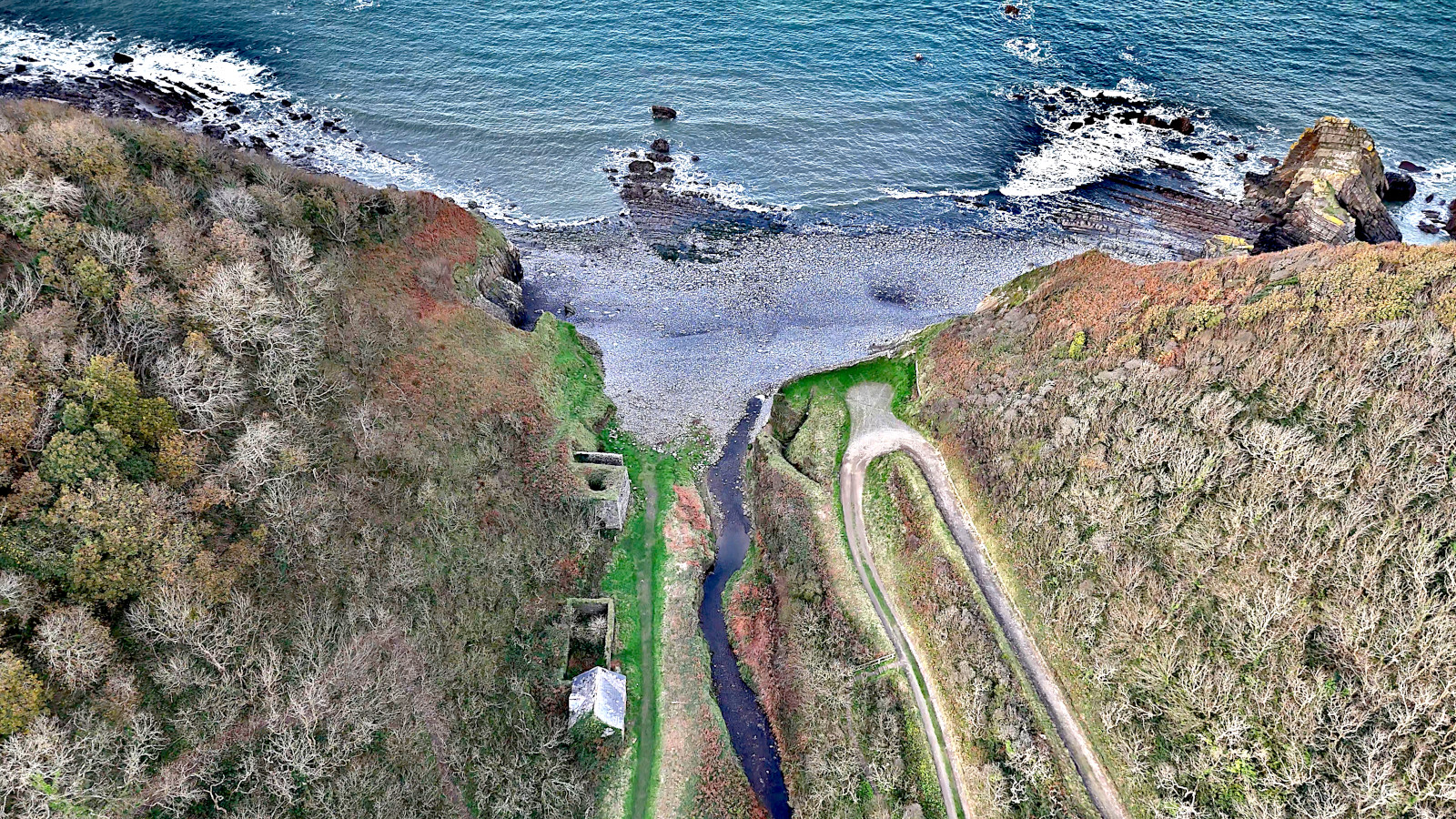
When the tide is out you can walk along the shore but it can be very difficult to traverse the rocks and pebbles, and you risk becoming stranded when the tide comes in if you do not have a planned route back to the cliff paths.
Climbing and descending the many valleys is challenging, requiring good footwear and stamina. The cliffs can reach great heights without barriers or fencing, necessitating a certain level of bravery.
Nearest Transport Links
Unfortunately, buses do not stop very close to Mouthmill Beach.
Velly, Lighthouse Cross Bus Stop
From here walk down the lane to Brownsham Car Park and join the footpath heading into Brownsham wood.
Clovelly, Visitor Centre Car Park Bus Stop
From here you can walk to Clovelly Court and onwards down the valley.
Local Amenities
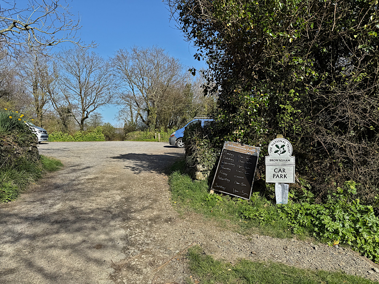
Just down from Brownsham carpark you will find the cosy Lower Brownsham Farm Tea Rooms for delicious cakes and refreshments.
During the summer season the Tea Room is open 11am - 4pm every day except Fridays.
Clovelly Court Gardens has a small entry fee but also has a shop.
Clovelly village has pubs and shops
Nearby Towns
Bideford
Bideford is an interesting port town on the River Torridge estuary with lots of heritage. It was one of the biggest ports in the country during the early immigration waves to America and Canada.
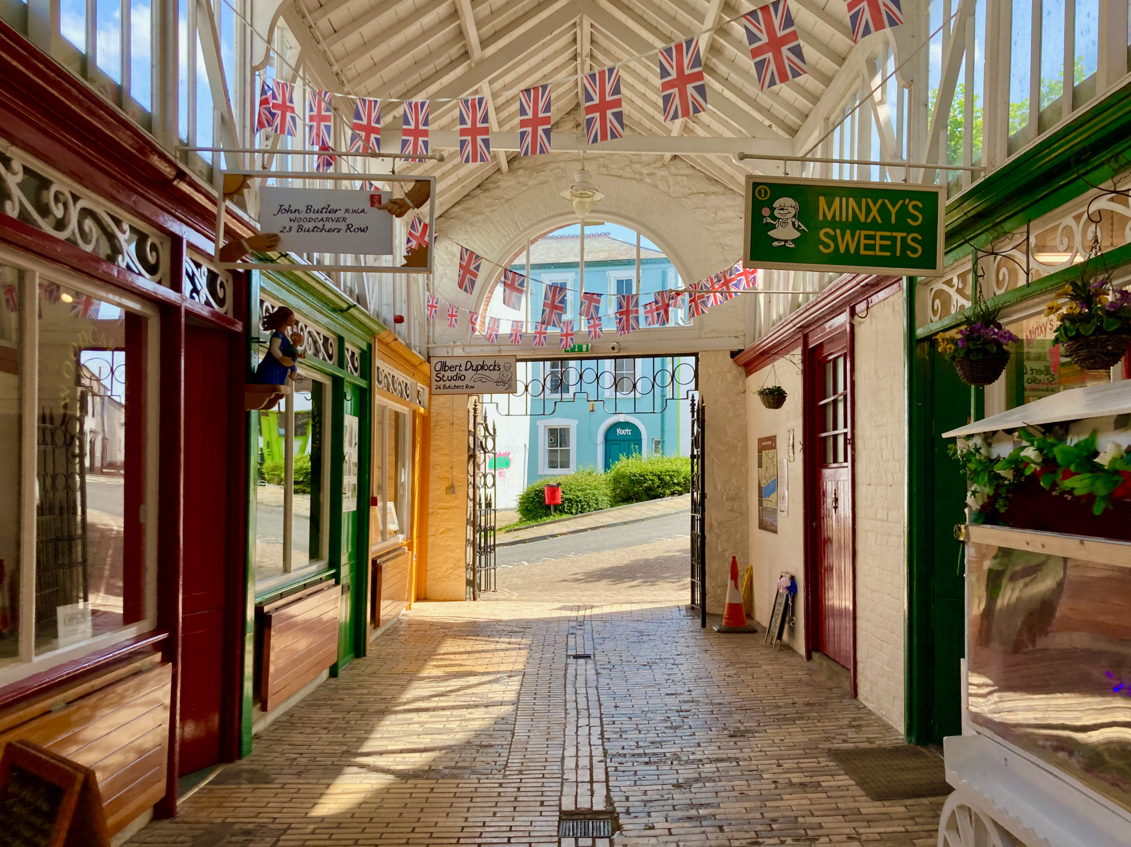
Clovelly
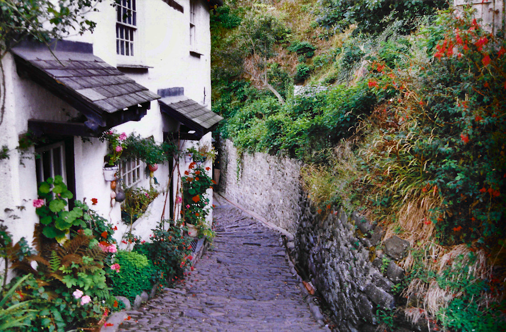
Clovelly is a fishing village frozen in time. It is the nearest village along the coast from Mouthmill Beach. It is privately owned, and visitors are charged an entrance fee at the Visitors Centre. People have lived here for over a thousand years, the village is situated in a steep valley with a cobbled stone road dramatically running down to the stone wall harbour at the bottom. The hill is tough to walk back up, so much so that many tourists end up saving their stamina and opting for a lift back to the top.
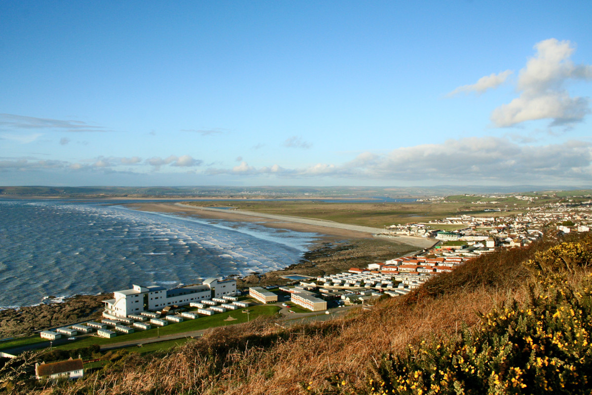
Westward Ho!
Westward Ho! is the only place in the UK with an exclamation mark in its name, because the town is named after a book by Charles Kingsley.
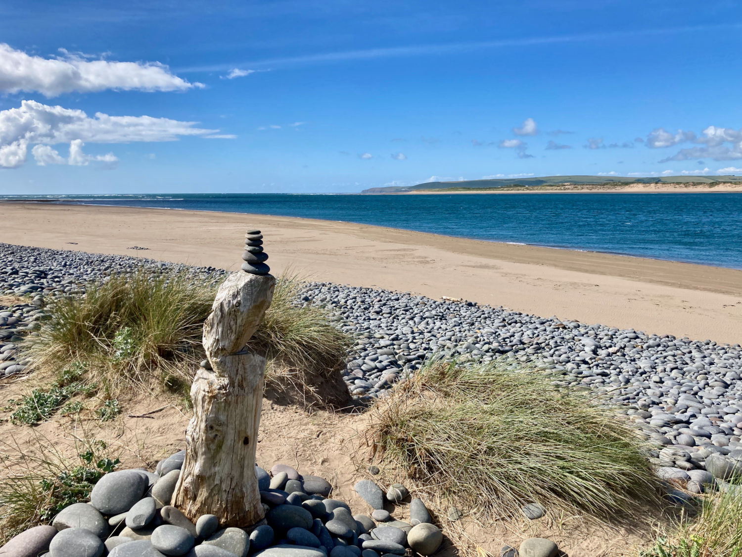
The sea-side town is known for its enormous golden beaches and the pebble ridge, which is a mysterious miles long ridge of millions of pebbles. There is also the remains of the Westward Ho! railway of which sections are now excellent foot-paths. Westward Ho! is a 3 mile trip along the A386 from the centre of the historic port town of Bideford.
First Aid
North Devon is very rural. The closest hospital with an Accident and Emergency department is in Barnstaple at North Devon District Hospital, which is a 38km (24 miles) or approximately a 40 minute drive away.
In case of emergency you might need the Coast Guard, which can be accessed via 999 like any other emergency service.
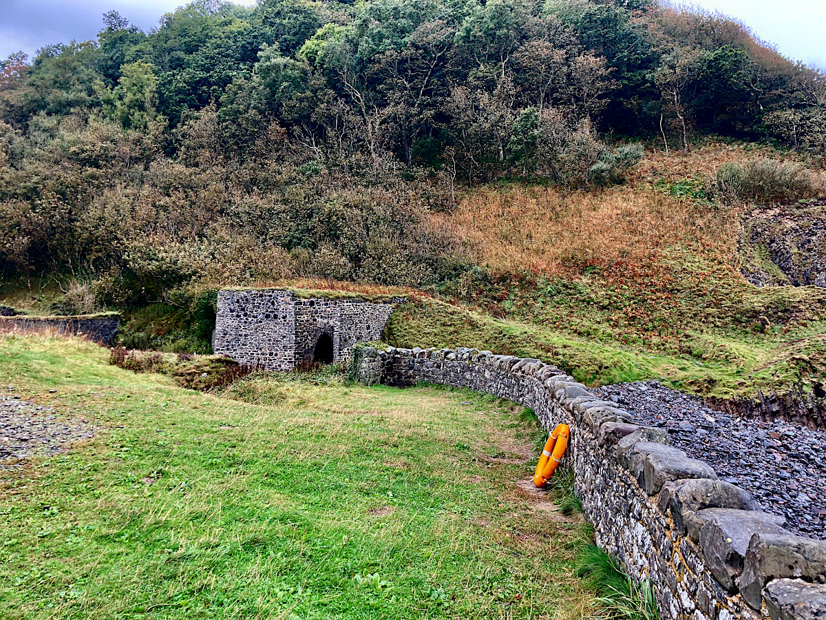
A Life Ring can usually be found behind the harbour wall.
The closest places you can usually find people are at Clovelly Court, or the village of Brownsham.
Accessibility
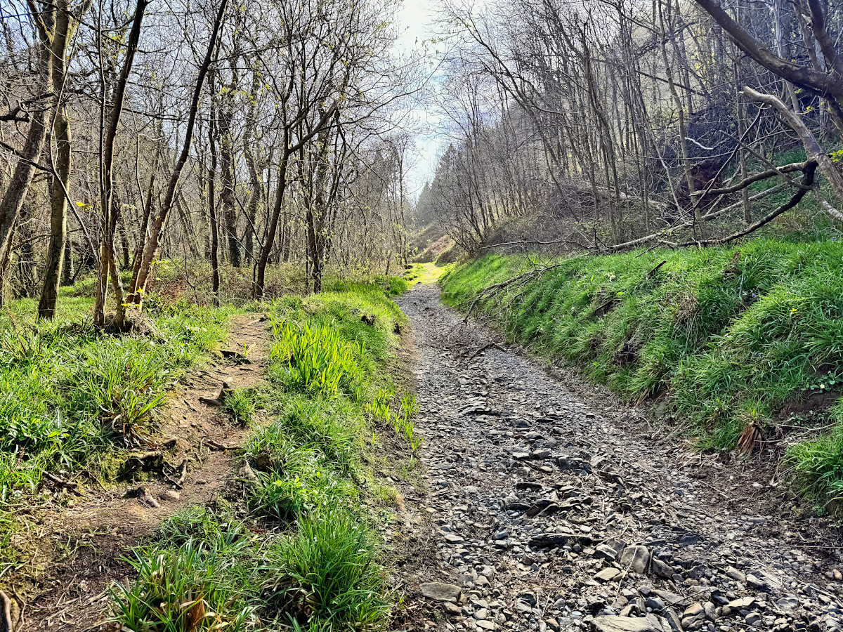
Unfortunately Mouthmill beach is not easily accessible to people who have difficulty walking. The 1.3 mile path from Brownsham car park is the easiest footpath, but can be uneven, muddy and rocky - however it is step-less, so could be accessible with ruggedised mobility and assistance. Recent storms have knocked a lot of branches onto the trail causing further obstacles. Pushchairs may need to be carried over wet boggy areas so I would recommended going after a stretch of dry weather to minimise this.
Attractions and Activities
Industrial Heritage
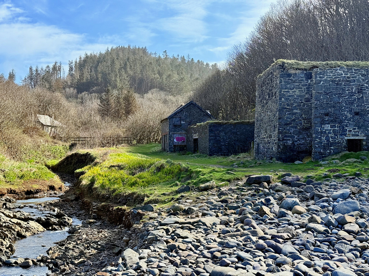
As you approach the coast, you’ll spot the cottage at the original Mill location. It’s in use as a private residence, so please be mindful to not disturb the house. Further down, you’ll find the Limers Cottage, coal shed, and kiln, which are worth exploring. Beyond the kiln on the left you will find the inclined plane leading up to the top of the lime kiln, take care as the deep brick lined pot is unfenced and overgrown and hard to see.
The limers cottage features colorful murals inside, and rumours of witchcraft and occultist usage.
The Environment
Mouthmill is a Site of Special Scientific Interest (SSSI) because of the special geology and habitats. The valley and cliffs are home to many rare flora and fauna, while dolphins and seals swim the shore as birds nest on the cliffs and in the trees. Keep an eye out for interesting species, and take extra care of the environment.
Seeing the Stone
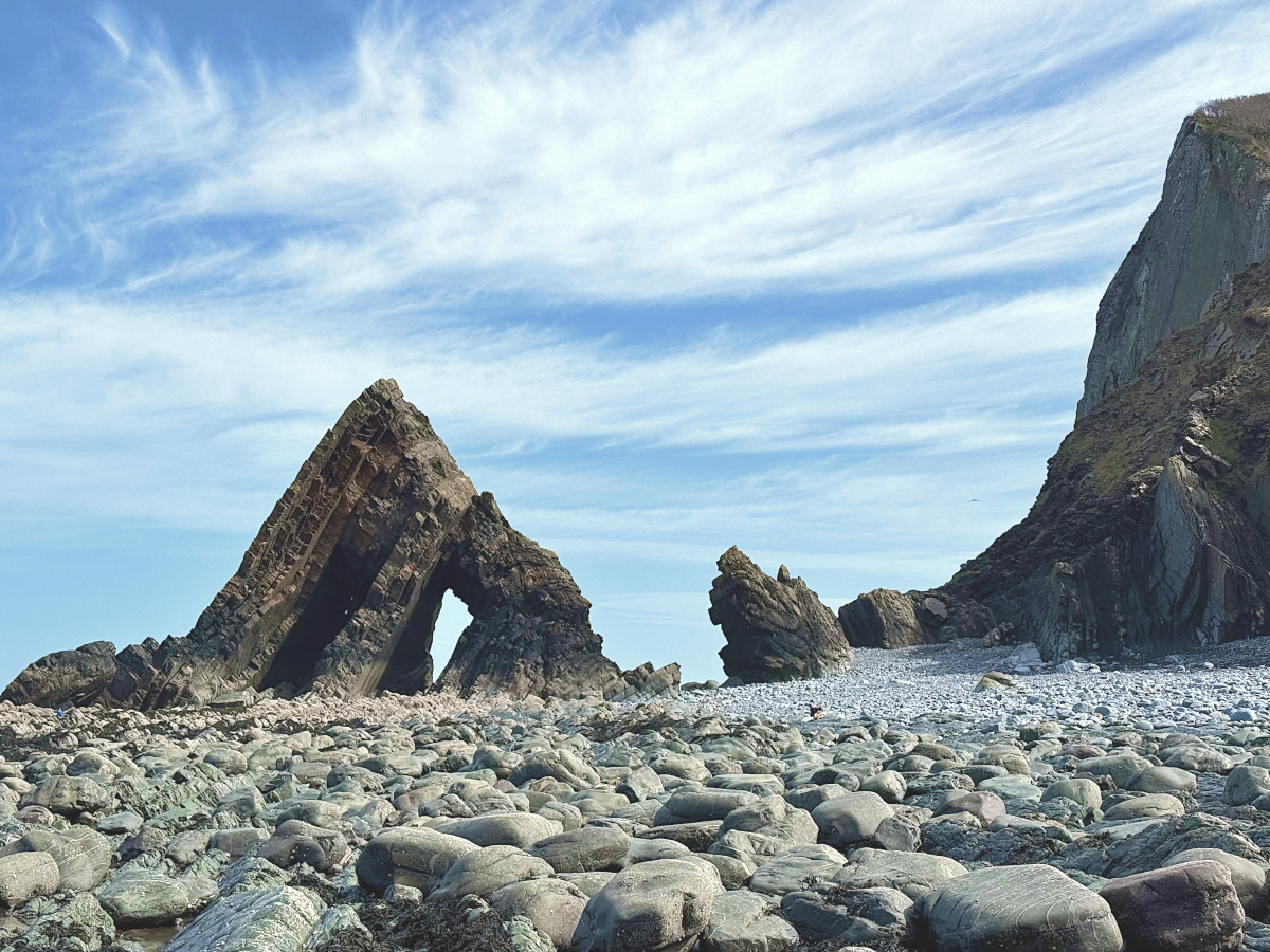
As you walk out onto the rocky shore you’ll encounter Blackchurch Rock, emerging from behind the East headland. It’s an awe inspiring sight, towering and elegant, much bigger than it appears in photos. If the tide is out, you can approach Blackchurch Rock and inspect it up close, even climbing through its gravity defying arches. When out on the coast always keep an eye on the tide to avoid getting stranded.
Study to understand
If you’re interested in geology, you’ll find plenty to study around the coast. 320 million year old spiral shelled Goniatite fossils may be found in the scree. You can become dizzy and mesmerised tracing the twists and folds of the strata.
Photographers love this section of coast. It is hard to take a bad photo out here. There are many good vantage points all over the valley, alongside the natural and industrial heritage.
Climbers sometimes scale the rock, with eyelets and ropes usually found on the summit. However, due to its size and slipperiness, it should only be attempted by experts.
Connecting with the coast
You may want to explore the 5000 years of human history and archaeological sites near Blackchurch Rock.
Youngsters love searching the rock pools for fish and crabs (you can buy a crabbing line and some bait from nearby coastal towns). Another common activity is Rock balancing, or pebble stacking.
This place means many things to many people, but peaceful coves with views out to sea have always been used as places for contemplation and unwinding. The pilgrimage down the valley can be rewarded with a rest.
Enjoying the area
Take a picnic and some drinks, and watch the sun set in one of the most beautiful places. While you relax, keep an eye out for dolphins and seals breaching the waves.
If the Tea Room is open at Brownsham, pop in and top up your tank with carbs and caffeine with delicious cake and tea.
If you want a keepsake or reminder of this wondrous place, you should not to take rocks or pebbles away from the shore because of its SSSI designation, so instead why not take a look at my photographic prints from Mouthmill. I also make a Blackchurch Rock sculpture which makes an excellent keepsake or gift.
BCR annual Meet - Come to Mouthmill precisely at lowest tide after noon on the Summer Solstice to meet up with fellow enthusiasts at the harbour wall for a chat.
Read more about the history
I hope this page helps you bring the goal of visiting Blackchurch Rock closer. The rock is a testament to time. Please read the human history (last 4000 years) and the geology (past 320 million years) to learn more.
I offer Printed photographs and also Sculptures of the monumental Blackchurch Rock, which help support this website. All photos on this site are original and up to date, taken between 2024 and 2025. If you have questions, suggestions or comments, please get in touch. Thank you for visiting!
Buy a BCR sculpture by a local artist.